We had a window of just five days (from Monday 5th September 2011) and since some of our superhuman friends have completed the UTMB race within the 46-hour window, we felt we ought to be able to get around the Tour in the time available to us. Right up front we would like to thank our good friends Pete, Dai & Cliff for their loan of kit, good advice & moral support.
Easyjet let us down with a delayed flight which meant that we missed our original ChamExpress transfer connection (see things to consider before booking) to Les Houches and thus arrived at the start more than two hours late. Too late to buy Gaz for the stove, but it was a beautiful evening so we opted to start out straight away and find accommodation where we could.
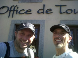
Day one: Monday evening, start 8pm, Les Houches Tourist Office
Inauspicious start as having found the first TMB sign, we instantly got lost, missing the wooden steps up the grassy bank and instead walking up into a small chalet estate, before retracing our steps and realising our mistake! In our defence, it was dusk and we were excited! Figured that we would walk up to Col de Voza or maybe as far as Les Contamines to find accommodation, but we might have been more focussed if it hadn’t been such a beautiful starry, moonlit evening.
The Col de Voza is reached by a steep but relatively easy path that rises 650m and the new hotel at the top with its lights blazing was a welcome sight. Yet we felt we were only just getting started so we continued onward, down an easy dirt track and then down the road to Bionnassay, managing to pass at least two refuges without noticing them and almost missing the discreet TMB signage in a couple of places.
After Bionnassay the path wanders gently through a wood crossing a very noisy river before reaching La Villette. Here we were supposed to bear left by the water trough, but we went down to the right and ended up walking up the main road to re-join the route where it crosses the road at Tresse.
We reached Contamines-Monjoie in 4-hours but, it being midnight, the town was quiet and even the bars were closed. After a search we located the CAF refuge, but this was locked and in darkness and since no-one answered the phone when we called, we continued onward. On exiting the town we passed an empty campsite and briefly contemplated bivouacking in a small kit room on the back of the building, but rejected it to continue along the path.
The route steepens shortly afterwards, but we felt sure we could find space at one of the refuges on the way up the hill ahead. Refuge Nant Borrant was locked and dark and although there was a small open summerhouse which we could have squeezed into, it seemed a little cheeky so we continued on.
A wave of tiredness hit us around here, circa 2am with a heavy dew settling on our packs and we tried the capsule of Quick Energy Orange power drink that we each had. It was totally disgusting, but the effect was pretty instantaneous and we were quickly on our way again. Will definitely take those again… along with a peg to soften the taste!
Refuge de la Balme had a couple of running-lights on that we had seen further down the valley and whilst most of the doors were locked, the door to the dormitory was open. We started to get ready outside so that we could creep in quietly, but were surprised by the owner and his son who effectively told us to get lost. I sympathise as it was 3am, but we did think this was the idea behind a refuge. He also earnestly warned about something ahead of us up the valley, but our French was insufficient to understand a single word of it so we apologised again and continued climbing.
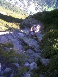
Above the refuge the route changed from grass to boulders and somewhere here we missed the route and ended up climbing a steep, loose gully. We got lucky though as it both flattened off at the top and re-joined the route… it’s hard to gauge gradient in the dark and I didn’t fancy either going back down the gully or striking out across the steep wet grass that bordered it.
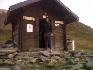
We continued to climb and shortly thereafter arrived at the Col du Bonhomme, where we found a small wooden structure that looked like a bus shelter. It had a wooden floor, was empty (bar a little rubbish) and had a door so by 4.20am we were putting additional layers on and rolling out our bivouac bags. It’s worth noting that we had opted to travel light, so had no sleeping bags to keep us warm, but rather only one bivouac bag and one Blizzard bag… the latter being lighter in weight and probably vaguely warmer.
Day one continued: Tuesday, start 6.45am, Col du Bonhomme
A cold and supremely uncomfortable one hour, forty minutes after laying down, there was a stirring deep inside my rucsac, by then acting as an awkward sleeping mat to try to keep the cold floor at bay. The alarm on my phone was going off: it starts by vibrating, then gradually increases in volume until it has the desired effect… and I had forgotten to set it to off. Alas, getting to it now and turning it off involved spilling whatever warm air there had been inside my Blizzard bag and waking everyone within about half a mile with the rustling… it’s like sleeping in a giant crisp packet. Fortunately there were only two of us to wake, this being a relative term anyway, which should not imply that we were particularly asleep! Forty minutes later, having both suffered intense muscle cramps in our legs from moving, we had given up trying to get warm or remotely comfortable and were on our way again.
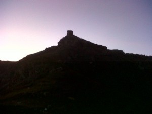
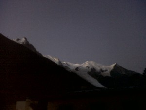
The window in the door gave on to an stunning view of Le Mont Bonhomme with its square block top and walking outside the view became more amazing still, with dawn breaking across the sky. The ground and puddles outside were frozen solid, so our chilly night was unsurprising… we were fortunate to have found shelter.
We walked on, traversing the mile or so across and 155m up to the Col de la Croix du Bonhomme with the sun highlighting the peaks around us. The Refuge du Bonhomme, 45 minutes into the day and just below the col, was a really welcome sight and breakfast wolfed down despite being somewhat meagre. Views canvassed from others later about the food there varied in the extreme, but dry bread, butter and runny honey eaten directly off the table (which did not seem that clean) did not earn any Michelin stars in my book. The bowls of coffee were welcome though as were the modern take on the traditional outhouse and the cold water trough for a quick wake-up wash, though I rather think that those staying had more modern facilities.
While we were eating breakfast, the walkers who had stayed the night (and in the main had taken since Saturday to reach this point) started to filter out, but despite stretching our legs down the hill we failed to catch anyone by the time we had dropped the 930m to Les Chapieux where the smell of cooking was wonderful.
As we had progressed ever downward in gloriously warm sunshine, passing a squad of soldiers with packs and guns marching in the other direction, we had planned a gentle jog down the valley floor that we could see stretching out ahead of us. Alas, we were disappointed then to find that the route actually turns left at the village, directly into a steep tarmac gradient and an icy wind.
The road climbs perilously along a shoulder in the valley and the views of the mountains on the far side are interesting, with precipitous rivers cut into them periodically ceiling-to-floor, but it’s otherwise a bit of a dismal climb to Ville des Glaciers. Especially when we realised that the others from the hut had taken the shorter, more scenic variant across the top of the mountain to this point. Given the choice again, we would have done likewise.
Kev Renolds describes the next section to Col de la Seign as neither long nor particularly arduous, but this was not our experience. In fact the 960m climb to the col from Les Chapieux was our second-least favourite section, after the 565m descent on the other side. Though to be fair this may have been more to do with lack of sleep and insufficient food, allied, ahem, to a competitiveness that drove us to overtake everyone else on the hill!
With sharp pains in my shoulders (which I much later realised was down to polling energetically both up and downhill) and above my knees, the sections on both sides of the col really dragged on. Once down into the Vallion de la Lée Blanche, Rif Elisabetta steadfastly refused to materialise and when it did finally hove into view, it was clear that we had to walk steeply up a winding track to get to it.
This was one of only two physical & emotional lows during the week and since both were largely down to tiredness and lack of food, I suggest that walkers anticipate this by resting and fuelling up regularly.
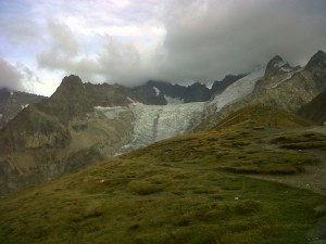
With slightly terse service and oily minestrone soup, Rif Elisabetta did not leave me with a positive impression, but the view up at Mont Blanc, the Glacier d’Estelle and the Glacier de la Lée Blanche was mightily impressive and the combination of this and the food revived us both physically and emotionally. After lunch we found a grass knoll out of the chilly wind on the valley floor and slept in the hot sun for about 90 minutes to complete our restoration.
Now revived, we eschewed the easy route down the valley floor to Courmayer in favour of the main TMB route which rises 480m, traverses the pastured side of the valley in a jolly manner and then descends an interminable 475m to the Col Chécrouit.
At 7pm, 23 hours and some 42 miles after starting the Tour, I almost melted when Luciana at Rif Maison Vieille said that she not only had space for us to stay, but that she would prepare a table for dinner (the other guests already eating and chatting noisily) while we had a hot shower. She and husband Giacomo Calosi run a quirky and extremely welcoming refuge and it was packed… and justifiably so. The food was delicious, greater in quantity than I could eat and the service had that unusual quality of making it clear that Rif Maison Vieille exists to delight its customers.
Day two: Wednesday, start 9.00am, Rif Maison Vieille, Col Chécrouit
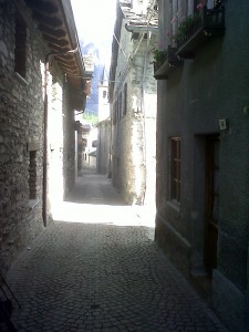
After a night in a comfortable bunk bed, a bright sunny morning saw us start down the steep hill to Dolonne 745m below, reminding us of the value of walking poles. Dolonne is an extremely pretty place with beautiful shops (including the very first shop that you reach which sells Gaz but is otherwise like an elegant London sports boutique) and narrow streets. From here it’s a short walk up the main road to Courmayer, neat, clean and bustling, with lovely shops selling delicious-looking fresh food. Sadly we were looking for chocolate and other less healthy foodstuffs and were out of luck in this respect in our quick look around.
The route rises 800m, first through lovely woods and then across pasture, passing Rif Bertone and a man sitting by the way who was enthusiastically scooping Nutella from an extremely heavy-looking glass jar. Once up there the path contours on a lazy contour which gives wonderful views down on the entrance to the Mont Blanc tunnel and (over your shoulder) back down the valley towards Rif Elisabetta and Col de la Seign.
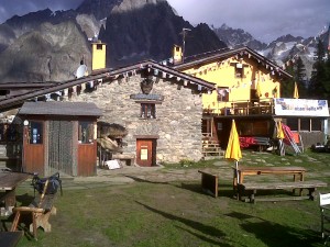
In the midst of this traverse Rif Bonatti sits seemingly just above the contour, although it turned out to be a hard five-minute climb when we got there. Friendly and (since we managed to beat the arrival of the crowd walking to here from Courmayer for the evening) pleasantly empty, we sat in the sun on the terrace and refuelled with polenta… though strictly speaking we refuelled without it, the texture not being especially appealing. The meat filling was delicious though so we at least cleaned half of our plates.
The path rises slightly from here and contours again for a while, this time across broad valleys with rushing streams at each centre and we were busy pondering which of the cols ahead we were going to be taken over when the path dropped abruptly 240m to Chalet Val Ferret on the valley floor.
Once down on the valley floor and across the river, the path wasted no time at all in taking us through the car park and skywards again, heading steeply up 280m to Rif Elena with a keen chilly wind blowing down off the glaciers beyond.
Somewhere on this hill are a beautiful and expensive pair of sunglasses, left inadvertently by my erstwhile colleague while he patiently waited to hand me some chocolate when we stopped to add layers.
Rif Elena is more like a club hotel than a refuge, with its underfloor heating and staff in matching purple t-shirts, but the service is good and welcoming. It was 5.30pm as we sat & deliberated whether to sprint across to the next hut, but as the guide book showed La Peule only as a refreshment stop and La Fouly was possibly 3 hours away, we decided to stay the night.
This meant that we were able to have hot showers (in possibly the smallest cubicle I imagine anyone makes), wash out our shirts, shorts and repulsive socks and sit comfortably to munch our way through plates of pasta, meat and fruit tart. I finished everything placed in front of me, but this was no reflection on portion size… I was just super-hungry!
Day three: Thursday, start 6.30am, Rif Elena
As we walked out the door so the Rif Elena staff were making their own early morning coffee and there was a vague light in the sky. They had provided us with breakfast-to-go consisting of an apple, chocolate bar and two simple rolls, one cheese and one salami. The apple was dispatched on the way up to the Grand Col Ferret, the path rising beside an unseen, deeply cut river, while we took in the amazing view back across at the Glacier Pré de Bar and back down the valley to Courmayer.
As we neared the top we passed four lively septuagenarian Swiss people coming the other way, presumably heading down into Italy for breakfast and we soon reached the Grand Col where the wind was icy. Ten paces later however and we were in a different world, warm with gentle pastoral contours leading us down into Switzerland. Just above La Peule we stopped to make hot chocolate (the one and only time we used the stove) and eat what turned out to be simple yet delicious rolls… service levels are something that I’m tuned to notice and these rolls were a simple indication that service really matters to the team at Rif Elena.
La Peule actually does have accommodation and it looked neat and clean as we walked past and on down the winding road to La Fouly. We passed several mule-supported walking parties coming up the other way, although we weren’t quite sure what the heavily-laden mules were carrying as the accompanying slowly-moving walkers were also more heavily laden than us.
After La Fouly there is a beautiful path (one of my favourite of the whole trip) which wends its way down the valley next to the river and despite slightly inconsistent signing we motored on down, stretching our pace out seemingly for the first time. Before the end of the wooded section is a huge and amazing moraine which we walked across the top of before dropping steeply to a road.
Here the route meanders down a broad, lush valley through the extremely picturesque Praz-de-Fort before passing a tiny café perched on the pavement in Issert. Here we stopped for a delicious omelette, just as well as this marks the end of the 1480m downhill section.
From here the path rises steeply 400m through delightful woods to Champex, passing numerous humorous wood carvings of toadstools and animal characters playing games… something to make you smile at every turn!
When Champex is finally reached there’s another surprise: after all the preceding mountain scenery, it’s just like being in the Italian Lakes. Hot and laid back in the sun, there’s a broad lake surrounded by moneyed buildings and an easy track that people were sauntering or running around. We stopped to buy water, unsure of any of the public supplies (although they were probably all drinking water), before walking on down a pastoral valley past the occasional pretty house to Plan d l’Au, at 4pm too early to stop.
The path from here to Bovine rises steeply 650m through woods and over rocks and rivers. It’s a lovely path, but no walk in the park, especially when you’ve already climbed 900m that day. Bizarrely, bearing in mind the tortured complexity of the path, it appeared as if someone had actually cycled down it, tyre tracks visible at regular intervals. We saw the technique in action on the final day and it’s quite a sight to see… they are really quite mad!
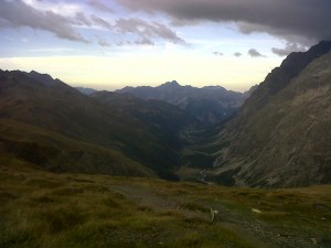
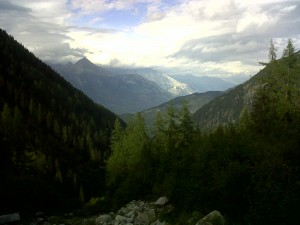
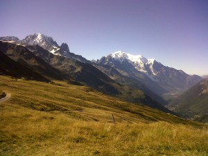
The path finally stops rising just above the treeline and then contours to the right giving truly magnificent views of the Rhone valley below and the mountains surrounding. The view is worth every step taken to get there and once again we were thankful for the extraordinary weather.
Bovine was a welcome sight, but alas we arrived at 6.30pm on the night before they moved their cattle to the lower pastures and since they were already relaxing into a bottle of wine (possibly not the first) they were not prepared to take guests. We walked on knowing that at least the Hotel du Col de la Forclaz, around an hour ahead, had one of 75 beds waiting for each of us.
The walk, which descends 500m after an initial rise, was painful in the extreme and dusk was falling by the time we reached it. Alas, due to a Swiss holiday, we found that it did in fact only have one bed left, the inn otherwise completely full. We ate a delicious pasta meal there (me feeling decidedly dejected, the other emotional & physical low of the trip) before walking out into the darkness to find a place to bivouac overnight. The food worked wonders though and we were once again in high spirits as we rejected several potential bivouac sites.
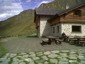
Fortunately we looked into the authentic refuge at La Peuty and found an almost empty hut and 34 sleeping spaces to choose from. This was one of the high points of the trip and after creeping in and quietly organising ourselves, a deep sleep ensued.
Day four: Friday, start 9.00am, Ref La Peuty
The ‘en-suite’ bathroom is in a block outside, down the steep steps to the refuge and 20m away, so despite full bladders and after such a big day (with circa 26 miles covered, over 1600m of ascent and 2300m of descent), we didn’t hurry to get up, waiting instead for the others in the hut to stir.
But our lay-in came at a price as we started to climb the 860m to the Col de Balme. We experienced the downside of the popular route and our slowing pace, finding it hard to pass or sufficiently leave behind a large group of walkers with a walkie-talkie blaring out periodically across the valley at full volume. There was nothing during our week that irked us as much as this, apart from the unrepentant attitude of the offending walker two hours later at the top when we tried to point out how disturbing it was and suggested he turned the volume down.
For our sin of pointing out what others were surely thinking, we then lost our way and had to walk past him ignominiously twice more before we settled on the route onward… still not the correct route but at least going to the right place. Pay attention to the route here in advance!
Having not yet breakfasted despite our long climb, we made for a small farm visible from the Col, inadvertently forsaking the main path over Aig des Posettes (with its apparently excellent views) for a friendly breakfast of hot homemade Apple Crumble and crème d’Anglaise, eaten beneath a fluttering Savoie flag.
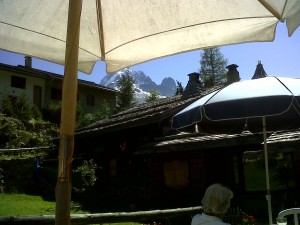
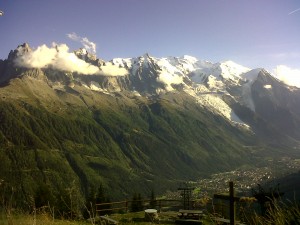
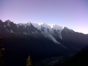
Revitalised, we then followed the path across the side of the valley, with its stunning views down the Chamonix valley and down steeply to Tré-le-Champ where a charming Auberge supplied us with a view up at the Mont Blanc massif in the hot sun and a delicious omelette to fuel our afternoon.
Revitalised for the second time in a day, we started walking the 470m up through delightful woods to the Aig d’Argentière and the base of the metal ladders. These enabled us to rise 240m vertically in about 100m horizontally and took us half an hour. It’s not a difficult ascent, but not for the faint of heart and at times it felt a little exposed: we were glad at every step that it was not a wet day, when the steps would surely be perilous.
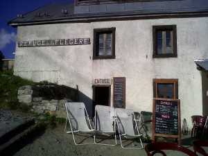
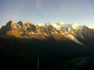
From the top at Téte-aux-Vents the route contours, with some rises and falls, to Ref la Flegère, where we were afforded the most enthusiastically friendly welcome of our entire trip, with the staff presumably buoyed by the fact that it was their final night of the season. We had phoned ahead from our apple crumble breakfast so at least knew there was space and after a hot shower we had a celebratory beer on the terrace with probably the finest view of Mont Blanc on the whole trip.
This was the first time that we were really able to engage with other walkers and we enjoyed a particularly lovely evening chatting to Greg & Pat from Aspen, Uri & Talie from Israel and Sam from Scotland. One of the clear benefits of walking the route in the normal 11 days is the camaraderie that develops with others who stay at the same places from night to night: presumably provided you don’t coincide with a large party with a loud walkie-talkie attitude.
Day five: Saturday, start 8.30am, Ref La Flégère
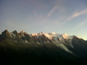
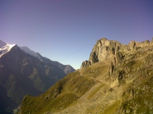
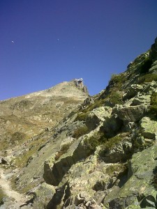
The walk initially contours along the valley side giving a constant elvolving view across at Mont Blanc, its aigs and its glaciers, all the more breath-taking thanks to yet another glorious, clear and sunny day. At Col du Brévent the Mont Blanc view is exchanged for the panorama of mountains to the north as the path rises across boulders, with the help of a couple of metal ladders, to the back of La Brévent, a striking lump of a mountain topped by an audaciously cantilevered cable-car station.
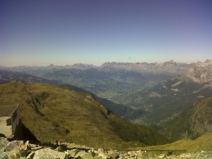
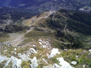
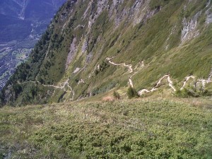
Arriving at the top from the back of the mountain presents the view across at Mont Blanc as an astounding finale, with a second more precipitous view over the balcony of the valley floor almost a vertical mile below. We thoroughly enjoyed a beer in the sun ahead of the inevitable descent, the greatest single height loss in the trip: at 1520m it’s slightly more than the drop from Grand Col Ferret to Issert but in less than a third of the distance. Although it really does seem to go on down forever!
The combination of an interesting and varied path, across boulders, through meadows and woodland, with the evolving views across and down the valley as you descend, make for a really pleasurable close to the trip, although it took us a strenuous two and a half hours to reach the bottom.
The path finally exits the woods adjacent to Les Houches railway station and the walk back across the valley to the Tourist Office was an anti-climax, but the beer in the hotel opposite the end was well earned indeed!
We checked at the Tourist Office for hotel spaces at Chamonix before enjoying a wonderful 90-minute pole-less walk up the track beside the river to get there. It was actually the perfect way to unwind after 4 days and 20 hours of walking.

